
Die Inhalte dieser Seite sind leider nicht auf Deutsch verfügbar.
Seitenpfad:
D4 - Constructional impacts on bedform dynamics
Volkhard Spieß, Tobias Mörz
Benjamin Schlue, Hanno Keil, Tilmann Schwenk
Benjamin Schlue, Hanno Keil, Tilmann Schwenk
The aim of this project is the geophysical and geotechnical seabed characterization, with a special focus on assigned offshore construction sites (e.g. wind energy parks), the correlation of survey information with soil strength data, and the study of local offshore structure-seabed interactions in a morphodynamic and micromechanical sense. A new shallow-water multichannel seismic system will be used to derive volume and reflector seismic properties, which can be compared with in-situ geotechnical measurements and samples to generate statistically significant correlations between geotechnical and geophysical data as predictive tools for sedimentary site characterization. New-pipe laying techniques in non-cohesive substrates will be evaluated, designed and tested. The project specifically addresses how upcoming offshore foundation activities may affect the dynamic strength of the Pleistocene and Holocene sediment. Within the framework of research area D, this project deals with an accurate site characterization by surveys, sampling and in-situ measurements, while the complimentary project D1 focuses on the environmental impact of harbors and constructions. Beyond the scientific and methodological challenges in shallow water research, the proposed project intends to provide relevant methods and data for future tasks in marine offshore construction work, to keep close contact with administration units (e.g. BSH, BGR) and survey (e.g. OSAE) and construction companies, and to build up expertise for student education in applied geosciences.
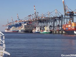
Specific Problems in using Organic Harbor Mud as Construction Material
In many harbors at shallow tidal estuarine systems problems arise with tide driven accumulation of highly organic mud. Dredging operations for maintenance of maneuverable harbor water depth lead to vast amounts of organic rich often contaminated sediment.
In many harbors at shallow tidal estuarine systems problems arise with tide driven accumulation of highly organic mud. Dredging operations for maintenance of maneuverable harbor water depth lead to vast amounts of organic rich often contaminated sediment.

Multifrequency Seismoacoustic Survey of a planned Wind Farm Area
The seismic data of a designated wind farm area off Borkum reveals that the wind farm area is located above the eastern flank of an updoming structure, probably a salt dome. The flank is located in depth of 170 to 280 meters. The near-surface structure is quite heterogeneous and characterized by numerous filled channels, often cut into each other.
The seismic data of a designated wind farm area off Borkum reveals that the wind farm area is located above the eastern flank of an updoming structure, probably a salt dome. The flank is located in depth of 170 to 280 meters. The near-surface structure is quite heterogeneous and characterized by numerous filled channels, often cut into each other.
