- Marine Geotechnics
- Cruises
- Meteor 167
Meteor 167
RV Meteor - Expedition M167
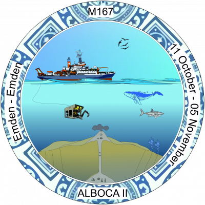
Emden (GER) - Emden (GER)
(11.10 - 05.11.2020)
Synopsis
Earthquakes (EQs) and landslides are the most common causes of tsunamis, all of which represent a major threat along the Southwestern European continental margin (e.g. Great Lisbon EQ of 1755, Mw>8.5). The most crucial knowledge for hazard mitigation is given by the recurrence intervals, the preconditioning factors and the triggers that favour such events in a determined region.
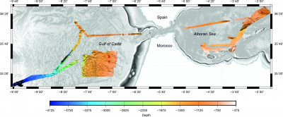
In this regard, the aim of cruise M167 is to study the recent condition of fluid and solid emissions at the plate boundary between Eurasia and Africa by several methods.
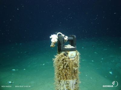
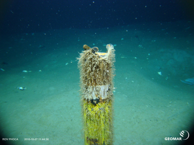
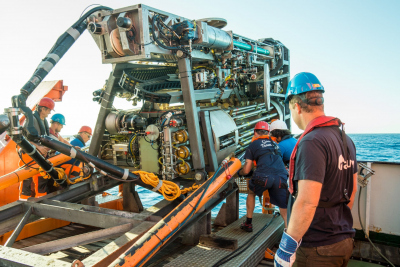
The first key element of the cruise is related to the EUMR project (EU Marine Robots), where MARUM is a key partner in providing access to robotic infrastructure. Practically, this encompasses a few tasks such as recovery of three long-term data set of in situ temperature, pressure and conductivity data (2018-2020) as part of Transnational Access with our Spanish collaborators. Due to the privileged location of the so called “MeBo CORKS” observatories on two active faults and on Ginsburg mud volcano (MV); the monitored parameters will allow us to shed much needed light on the relationship between EQs and fluid emission in the Gulf of Cadiz. This will lay the foundation to understand the episodic nature of seismicity offshore the SW Iberian peninsula. Also, the vicinity of the MeBo-observatory locations will be surveyed by ROV SQUID to exploit recently developed photo- and video mosaicking techniques to produce 3D maps and images with key features along the fault zones and mud domes. Finally, part of the recent developments at MARUM in the context of smaller ROVs, e.g. a ROV-operable fluid sampler or some features in a COTS BlueROV system will be tested during the cruise.
Scientific Programme
The westernmost portion of the Mediterranean Sea is tectonically complex, given the controversial views on the nature and location of the Africa-Eurasia plate boundary and the significance of the Azores-Gibraltar transform fault. At the same time, this region has suffered from frequent, large magnitude earthquakes with epicentres both on- and offshore, and has an instrumental seismic record too imprecise for reliable risk assessment or determination of recurrence times in the seismic cycle. The expedition M167 scientific objectives will contribute to elucidate the seismicity of the Southwestern Iberian Margin by answering to two critical questions:
- What do monitoring of active fluid emission features reveal about seismicity in the 2018-2020 period?
- How did the monitored features change between the M149 and the M167 cruises in terms of geochemical fluid signatures, morphology, etc.?
In order to answer these questions, the scientific programme will include the following approaches:
- Recover the “MeBo Corks” observatories with the ROV SQUID to assess episodic emission of sediments and/or fluids in key locations instrumented during the former expedition M149 with the MeBo seafloor drill;
- Sample sediment material from deep-seated faults using gravity coring;
- Sample sediment material from active mud volcanoes using gravity coring;
- Acquire detailed temperature profiles over the plate boundary fault system and active mud volcanoes using the ROV with T-stick;
- Acquire photo-/videomosaicking and biological samples with the ROV SQUID to investigate ongoing biogeochemical processes on active MVs;
- Sample a newly discovered MVs field using ROV SQUID, and particularly collect quality samples with a new ROV-operable fluid sampler in key locations.
Fig. 2: MeBo70 seafloor drill rig and example of MeBo observatories, which are envisaged to be recovered during cruise M167 through the ROV SQUID.


