- Marine Geotechnics
- Cruises
- SONNE 292-2
- Weekly Reports
Weekly Reports
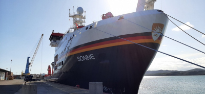
All the scientific participants of expedition SO292/2 boarded the ship in the early morning of the 23rd of June, after being tested for COVID before their respective flight, on land in Nouméa, and upon setting foot on the ship. The testing will continue during the following 5 days, in order to minimize the chances of contagion. The containers for the SO292/2 and the subsequent expedition (SO293) arrived as soon as the ship docked, on the 21st, and were consequently loaded. Due to the deferred arrival of several pieces of luggage from both the scientific and the ship’s crew, the departure has been delayed to 22:00 on the 24th.
Currently, we are sailing between New Caledonia and the Solomon Islands, on our way to the Central-Western Pacific, where we are planning to investigate the geodynamic processes and geochemical cycles in the Mariana Trench subduction zone. Mud volcanoes, seafloor expulsion structures which are scattered through the forearc, are known features in the area and they have a crucial role in recycling of subducted sediments and even hydrated forearc mantle material to the seafloor. In the region, the nature of the emitted sediments (mostly clast-rich dark blue serpentinite mud) and fluids (high pH and variable composition with increasing distance from the deep-sea trench) is unique and revealing of the processes happening at plates interface depths. The R/V Sonne will sample selected serpentinite mud volcanoes at varying distances from the trench in order to characterize the fluid and solid end members of the extrusives. Among the key goals of the cruise is also the deployment of two long-term instruments that will be measuring different physical parameter in the sediments of the Mariana mud volcanoes, and will be recovered during a subsequent expedition.
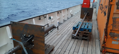
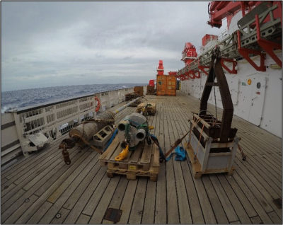
Transit to the first working area will be approximately 2600 NM and last for about 9 days, in the meanwhile the scientific crew is and will be busy with unpacking all the scientific equipment, lashing the instruments for transit, equipping the laboratories and discussing about their own research during various scientific meeting. The scientists onboard are 22, between Professors, Postdocs, Technicians, undergrads and postgrads students from MARUM, University of Innsbruck, MPI-M, MPI-C, University of Szczecin, HafenCity University and Chiba University, representing a number of 7 different nationalities.
While the marine geologists are looking forward and very eager to start their research and sample the first sediments/rocks, the meteorologists and the hydroacoustics team started collecting data as soon as we were in open waters. This transit from S to N pacific will allow them to collect precious information on atmospheric properties of aerosol, clouds and trace-gases, which will serve as i) calibration data for satellite remote sensing retrievals, and ii) evaluation data for (global) modeling.
We send the best wishes from the Southern Pacific and take this opportunity to especially thank the BMBF, the PTJ, the German Research Fleet Coordination Centre, the shipping company Briese Research and the crew of the R/V SONNE for the tremendous support they have provided in preparing the cruise.
On behalf of the entire SO292/2 Team
Walter Menapace (Chief Scientist)
2. Weekly report (27.06-03.07.2022)
For most part of the second week onboard R/V Sonne, we steamed towards the southernmost of our two study areas, in the Mariana Forearc, NE of Guam. The transit, which started on the 25.06, will end this Sunday, with the entrance in the Northern Mariana Islands EEZ.
The transit itself actually gave us the possibility to discuss the different geological features encounter on the Pacific Ocean seafloor during our way north, such as the tectonic settings of the Solomon Sea microplate, the formation of Pacific seamounts and guyots, and the emplacement of the Ontong Java Plateau. This LIP (Large Igneous Province) formed about 120 Myr ago and coincides with the Early Aptian oceanic anoxic event (Tejada et al., 2009), which was possibly caused by its massive basalts outpour on the seafloor.
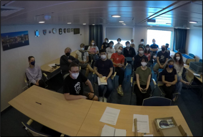
During the whole week the scientists, which are mostly new to the ship, had the chance to get acquainted with the life on board and had to participate to the mandatory safety drill simulating an abandon ship situation. Science also kept the SO292/2 participants busy, laboratories were prepared for the first “core on deck”, science meetings were held daily in the conference room, and continuous multibeam and parasound profiles were taken during transit, in order to contribute to the DAM Underway Bathymetry project.
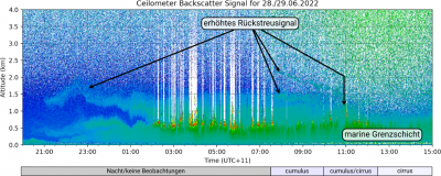
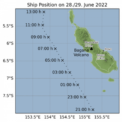
In addition, exciting data are currently being produced by the atmospheric scientists onboard: on the night of June 28th to 29th at around 9 p.m. ship time (UTC+11), an increased backscatter signal was initially detected in the data of the ceilometer at an altitude of about 1.5 km, which indicates a indicates aerosol plume. As the aerosol plume reaches the top of the marine boundary layer, cloud formation increases. The time series measured by the ceilometer shows several similar backscatter signals between 1.0 and 2.5 km in the course of the morning. When the signal can no longer be detected by the ceilometer at around 12 noon ship time, the clouds also clear up again. L1/L2 type cumulus clouds were confirmed by onboard cloud observations up until about 12 noon. Afterwards cirrus clouds prevailed, low clouds were no longer observed.
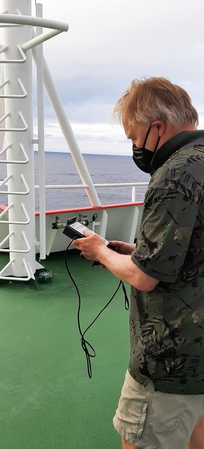
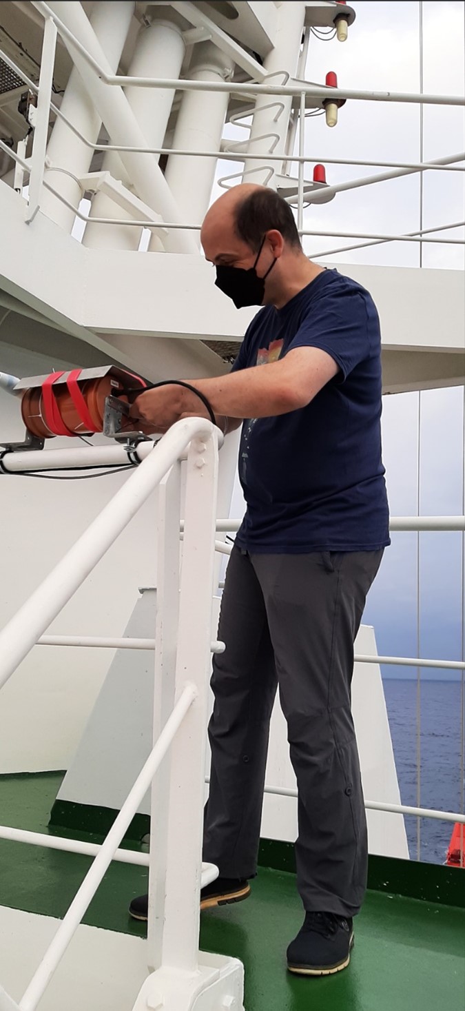
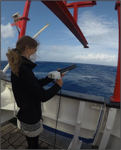
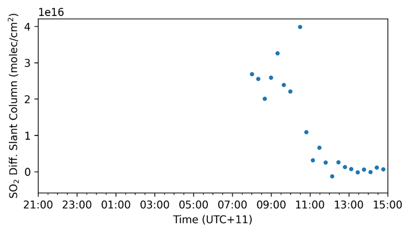
After sunrise, the increased aerosol signal could also be confirmed by the sun photometer: The aerosol optical thickness was increased by about 0.06. The measurements of the Tube MAX-DOAS instrument were then able to provide a crucial indication of the origin of this aerosol layer: While most trace gases show the course of the day to be expected, in the morning hours until around 11:30 a.m. the inclined column densities (DSCDs) of sulfur dioxide (SO2) significantly increased. The fact that the signal is similarly strong for all elevation angles indicates an increased detection of the SO2 plume, which is consistent with the increased backscatter signals from the ceilometer.
The increase in the trace gas nitrogen dioxide (NO2) typical of anthropogenic sources (e.g. ship exhaust plumes) could not be detected, which suggests a plume of natural origin. A volcanic plume matches all phenomena shown and a look at the list of active volcanoes in the area shows the moderately active Bagana Volcano (Papua New Guinea) as a suitable source. For more precise statements, however, further analyzes must be carried out.
The scientific coring program is about to start, and all the SO292/2 participants are looking forward to give their contribution to the expedition. Everyone on board is feeling well and is enjoying the warm temperature and nice weather. More science will come in the next weeks, things are about to get even more interesting!
On behalf of the entire SO292/2 Team
Walter Menapace (Chief Scientist)
3. Weekly report (04.07-10.07.2022)
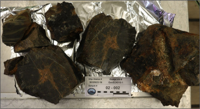
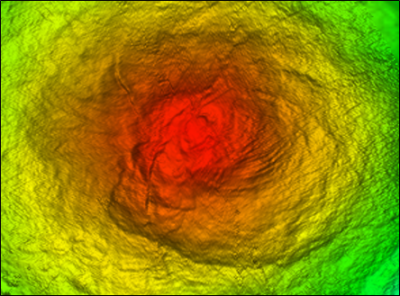
The week started in the Southern Mariana forearc, the first of our two study areas. During the night we could extensively map the target MV (MV) situated between 6,000 and 7,000 mbsl, being able to produce a nice map of the structure. Taking advantage of the beautiful weather and the perfect sea conditions on Monday the 4th we deployed the gravity cores, in order to sample diverse morphological features on the MV. Unfortunately the coring operations revealed more difficult than expected, with a low core retrieval. Nonetheless, we continued the scientific program with a dredge profile on the same target, which allowed us to collect a suite of different rock clasts from both lower and upper plate.
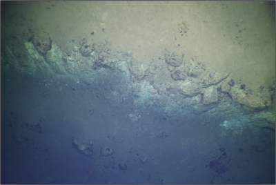
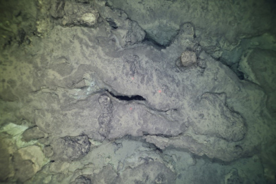
Subsequently, we used the RV Sonne own OFOS (Ocean Seafloor Observation System) to image the MV, getting spectacular footage of a clasts-rich ocean seafloor, mudflow terraces, and brucite chimneys. This not only confirmed the mud volcanic nature of this feature, but also allowed us to select a proper site for the deployment of the long-term pressure and temperature (p-T) observatory we built at MARUM. The NCB Observatory was then safely released on the seafloor on the 05.07., with the purpose of monitoring the p-T parameters of the MV sediments in the years to come, until its future retrieval. Such parameters will be key to understand the plate dynamic and the role of MVes in the fluid and solid cycling of the Mariana Subduction Zone.
We then steamed away in the direction of our second working area, in the Northern Mariana Forearc, which we reached on the 6th of July. Here we focused our research on multiple seafloor structures: Pacman MV, Cerulean Springs, Conical MV, a deep-sea basin E of Conical and two newly discovered MVs.
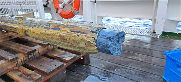
Multiple gravity cores have been done during the rest of the week, coring known features (Pacman, Conical and Cerulean Springs), as well as two new structures, which were identified as MVs due to retrieval of serpentinite muds. These sample will be studied in order to determine the geochemical composition of the porewater, as well as the presence of microbial activity, in an effort to shed some light on the origin of the fluids and the life which they could fuel.
Two further OFOS dives were performed at Cerulean Springs and Conical, with the latter returning spectacular images of carbonate chimneys, ferromanganese crusts and deep fractures scattered on the seafloor. Moreover, we deployed the dredge two more times on Conical and Pacman, getting a discrete amount of samples which will be driving further petrological studies once onshore. The site selected for the deployment of our second observatory was Cerulean Springs, as it has been identified in the past as the one with the highest fluid flow emission of the whole forearc (Mottl et al, 2003). The second NCB observatory was also flawlessly deployed on the 07.07, in a location chosen from the seafloor imagery of the OFOS dive and a temperature profile perpendicular to it.
Finally, we also managed to core a deep-sea basin in the forearc, and two new MVs, which recovered respectively a turbidite record and beautiful blue serpentinite muds. Despite the limited time at sea and the difficult targets (MVs are notoriously difficult to core), the SO292/2 expedition already set several records, namely: i) longest OFOS dive at maximum instrument depth (6000 mbsl), ii) deepest MV ever discovered, sampled and instrumented, and finally iii) first turbidite record of the Mariana Forearc retrieved after the DSDP Leg 60 in 1982.
Every scientific and crew participant is contributing to the success of this expedition and, as the days go by and the masks mandate wears off, the scientific team gets more united, making work and living on board very pleasant.
On behalf of the entire SO292/2 Team
Walter Menapace (Chief Scientist)
4. Weekly report (11.07-17.07.2022)
At the beginning of the week we started the transit, which will terminate with our arrival to Unalaska (Aleutian Islands). During our crossing we did several interesting encounters, both on the surface as well as on the seafloor. By progressively getting into the colder, nutrients-rich waters of the northern Pacific we are increasingly spotting marine mammals, while the ocean seafloor reveals to us through different structures.
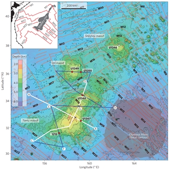
After crossing the Mariana Trench on Monday, we passed over the Marcus Necker Ridge, a submarine seamount chain subducting under the Philippine Sea plate, partly responsible for the Mariana arc curvature (Miller et al., 2006). We then transited over the Shatsky Rise, a vast LIP which hosted one of the largest volcano of the whole solar system (Sager et al., 2013). Right after we encountered the Emperor Chain, the oldest part of the Hawaiian Seamount Chain, often referred to in the geology textbooks as a clear example of both hotspot volcanism and rapid direction shift in plate motion. Finally, towards the end of the expedition we will pass over the Aleutian Trench, therefore crossing the fourth oceanic trench during our way north, together with the New Britain, Melanesian and Mariana Trenches.
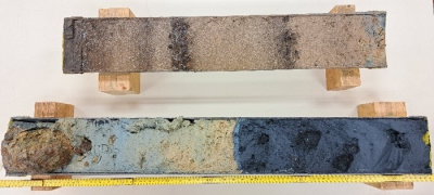
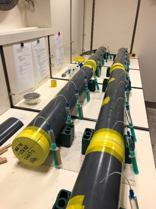
Meanwhile, the work on the samples collected in the working areas is still going on, with the scientists processing the cores and the dredge hauls material. In order to be able to use the samples in future publications, everything has to be thoroughly catalogued and stored adequately, with the corresponding metadata. Preliminary results show that elevated pH (8-9) values are associated with pore waters from freshly erupted muds at the sampling sites and possible depleted mantle ultramafic rocks have been erupted by the mud volcanoes.
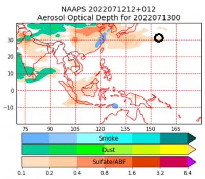
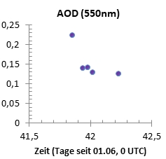
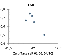
The underway atmospheric measurements did also reveal something unexpected, so far into the pacific. On July 12, the instruments recorded strongly enhanced Aerosol Optical Depth values (AOD) and also slightly raised fine-mode fractions (FMF). These elevated aerosol properties occurred early in the morning (12.07@20 UTC) at about 31.5° N and 155.5° E. As the ship headed further north the signal slowly faded. At that time a frontal system (with heavy showers) had passed over us and apparently carried on its backside the pollution from East Asia. This pollution advection was confirmed by the NRL forecast model.
The SO292/2 expedition is now coming to an end, with the RV Sonne entering the Aleutian EEZ (USA) after passing unscathed through the whole northern Pacific. The scientists onboard are still busy with labs cleaning, packing, writing down results, and enjoying the last days onboard, before disembarking on the 21st of July in Dutch Harbor (Unalaska). In conclusion, I would like to express my appreciation to the work of both scientists and crew, which allowed a smooth and successful completion of this research expedition.
On behalf of the entire SO292/2 Team
Walter Menapace (Chief Scientist)
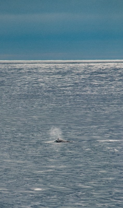
(Photo credit: Palash Kumawat)


