- Home
- Discover
- Ship's logs
- Logbuch M180
Logbuch M180
Expedition M180 SONETT (Synoptic Observations - a Nested approach to study Energy Transfer & Turbulence in the ocean) is a key part of the ocean observations in the second phase of TRR181 'Energy transfers in Atmosphere and Ocean'. The expedition will take scientists to an ocean region where they can observe many processes that affect energy fluxes in the ocean and the ocean's exchange with the atmosphere.
Researchers from MARUM - Center for Marine and Environmental Sciences at the University of Bremen, the University of Bremen, the University of Hamburg, the Institute for Baltic Sea Research Warnemünde (IOW) and the Helmholtz Center Hereon are involved.
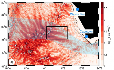
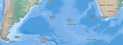
The working area is located southeast of the Walvis Ridge in the eastern South Atlantic. In this region, the so-called Agulhas eddies, which are formed at the southern tip of Africa and migrate northward through the Atlantic, meet internal tides generated at the Walvis Ridge, and affect the propagation of internal tidal waves. The eddies form fronts and so-called filaments at their edges. Filaments are structures that form where different water masses meet. They look like elongated fingers on satellite images. The planned observations include surface fluxes and waves, surface layer processes, mesoscale and submesoscale variability, horizontal mixing, internal wave energy fluxes, the interaction between internal waves and eddies, and the energy dissipation in the ocean interior.
The observations will be complemented by runs of a high-resolution ocean circulation model with tidal forcing (ICON SMT-WAVE) from the Max Planck Institute for Meteorology in Hamburg, Germany, which will allow to contextualize the observations, understand processes, and characterize the energy balance of this ocean region.
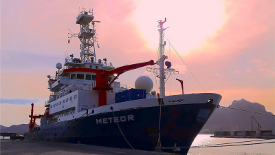
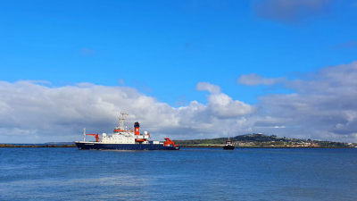
The expedition starts on February 23 in Montevideo (Uruguay), on April 14 the team is expected back with METEOR in Cape Town (South Africa).
Here, the researchers will report on life and work on board in a logbook.
22 February 2022: Let's go!
The team of scientists participating in the SONETT expedition arrived at Montevideo safely after a long trip from Germany. There was a transfer from the airport directly to the research vessel RV METEOR. On the same day, repeat PCR-tests were done for all the crew and the scientists. The next day, RV METEOR began the journey from the port of Montevideo, and the PCR-test results were negative for all the members on the ship.
However, to ensure everyone’s safety during the cruise, strict hygiene and safety measures are implemented to prevent a COVID infection on the ship. For this, one week of daily self-testing and masking at all times is currently in place for all members on the ship. After one week, a PCR-test will be done for everyone again. In accordance with the safety protocols, FFP2 masks, Rapid Antigen tests, PCR-tests, as well as vaccines are provided on the ship. In addition, necessary medication and a small hospital with necessary equipment is also available. Wishing everyone a healthy cruise!
Text by Manita Chouksey
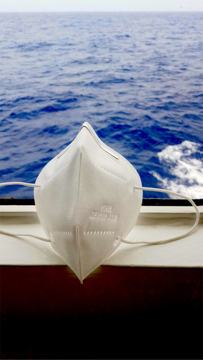
23 February 2022: Sail away!
The negative test results, from the PCR-test done the day before, raised our spirits for our expedition. After breakfast, everyone was out on the ship’s deck watching the ship leave the port and the skyline of Montevideo slowly merging with the horizon.
With loads of excitement for our expedition we bid farewell to the beautiful landscape of Montevideo, keeping its imagery alive until we see the next piece of land - after seven weeks.
Text by Manita Chouksey
24 February 2022: Unpacking
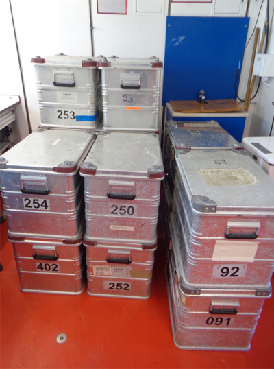
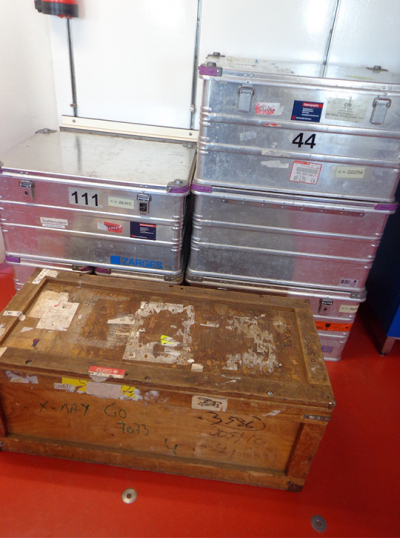
After a long journey on land and air from Germany to Uruguay, where RV Meteor awaited us, a yet longer journey across the ocean lies before us. But the relaxing sight of the blue ocean stretching before us, and the rippling waves take away our fatigue. However, there is no time to relax! All science groups are already busy unpacking their containers that are packed with various oceanic devices: CTD, LADCP, Microstructure, Scanfish, Catamaran, Gliders, and Drifters.
These devices measure different parameters of the ocean, such as temperature, salinity, density, and currents. In addition, a meteorological unit is also installed on the mast of the ship, which is about 35m tall, to measure surface components of the ocean that interact with the atmosphere. After unpacking begins the assembly of different components and setting up of laboratories for each device unit. Once the installation of an instrument is complete, it will be tested before it is ready to make the actual measurements. Hoping that all instruments are as active as we are!
Text by Manita Chouksey
25 February 2022: Making a Float float
The scientists are still busy assembling different instruments and installing various components. Some instruments are complete after assembly and ready to be tested.
We begin by deploying an Argo float as a part of the United Nations World Climate Research Program. An Argo float is a robotic instrument that drifts with the ocean currents and moves up and down while measuring temperature, salinity, and density from inside the ocean surface. Many such Argo floats are floating and collecting valuable data in many parts of the ocean for over two decades. Argo floats are a great aid to oceanographers to get information about the ocean without actually being out on a ship at sea. More information about the Argo floats and how they measure ocean data can be found here: https://argo.ucsd.edu/
Did you know the name ‘Argo’ was inspired by a mythical lore? The name ‘Argo’ was chosen since the float program works together with the earth observing satellite ‘Jason’, that measures the shape of the ocean surface. In Greek mythology, Argo was a godly built ship on which Jason had sailed accompanied by Argonauts in quest of the Golden Fleece. The ship Argo has since then appeared in various forms of art and literature.
Science is not limited to science!
Text by Manita Chouksey
25 February 2022: Tests and more tests
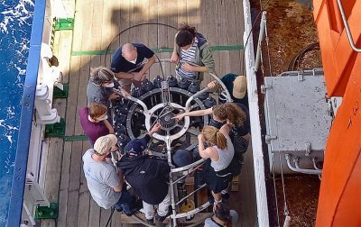
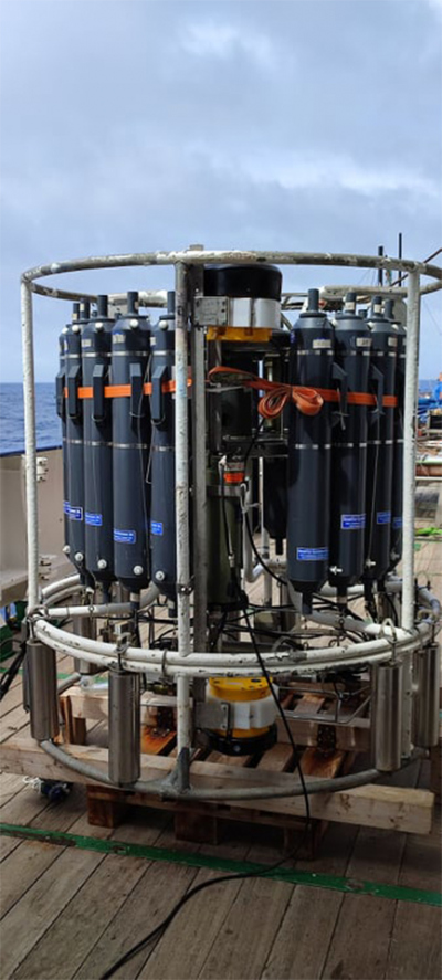
On the other side of the ship, another group of scientists have been busy mounting the CTD and LADCP on the sampling unit that can be lowered to thousands of meters in the ocean to collect data. The CTD measures water temperature, salinity, and depth; the LADCP measures velocity of ocean currents; and the sampling unit consists of circularly arranged long bottles that are used to collect water samples from various oceanic depths.
After a tutorial by Reiner Steinfeldt (Universität Bremen) on how to prepare and operate the CTD instrument package, the CTD, together with LADCP, was tested by lowering the unit into the ocean down to 1000m and 200m depth. The test was successful and all the mounted instruments worked smoothly. Now we are ready to collect lots of data from the CTD as soon as we arrive in our working area: the Walvis ridge region in the South Atlantic Ocean. But there is still a long way to go!
Text by Manita Chouksey
26 February 2022: Going with the flow
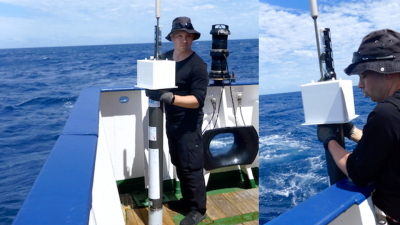
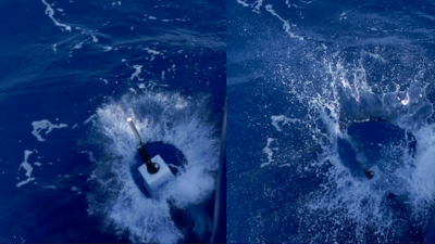
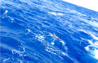
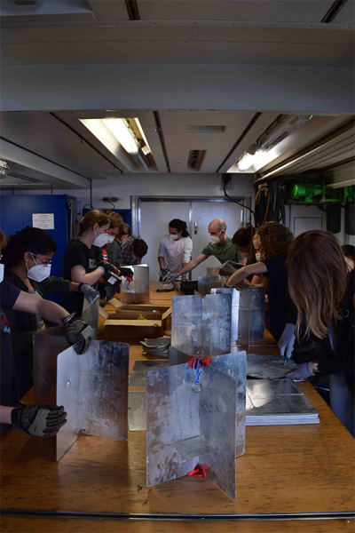
The scientific crew on board of the Meteor gathers to assemble 44 drifters. Now, they are ready to launch!
Today, at 13:00pm (ship time), directly after refuelling at lunch, all scientists on board joined to assemble 44 Hereon-designed surface (1m-deep drogue) drifters.
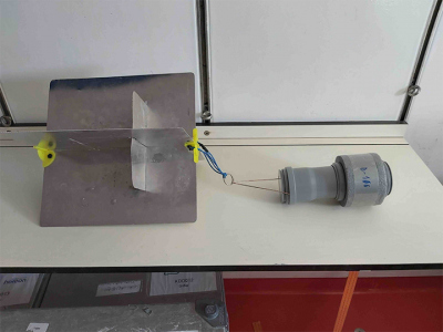
These consist of two main parts: the drogue and the float. The float (grey capsule) stays throughout the measurement on the sea-surface transmitting its position via Iridium Satellite Communications. The drogue plays a similar role to a sail on a boat, such that the currents drift the instrument. Additionally, a total amount of 20 deep SV-drifters (15m-deep drogue) will be deployed together with the shallower ones.
This project is part of the working group L3 “Meso- to submesoscale turbulence in the ocean” from the collaborative TRR181 “Energy transfers in Atmosphere and Ocean”. I spoke to two scientists who will be using this data to find out their interests and strategies towards their scientific goals.
Dr. Alexa Griesel (project leader of L3 together with Dr. Maren Walter) explained that their interest lies in the dependency of the energy distribution on different scales and the dispersion of particles in different turbulent regimes. She specifies: “The goals include computing energy transfer rates that could give insight into how much energy is transferred from smaller to larger scales, and diffusivities that characterize the lateral mixing.” For that, the behaviour of surface drifters is compared to the deep ones and additional observations.
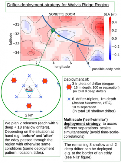
Dr. Julia Dräger-Dietel (PostDoc in L3) shared her deployment strategy and comments: “Our aim is to combine the results from the statistical analysis of the drifter's trajectories with other in situ measurements (ADCP, microstructure measurements, CTDs). To link small (10 m) and large-scale dynamics (1000 km) we developed a deployment strategy, which ensures the simultaneous measurements of different scales.”
Text by Pablo Sebastia Saez
01 March 2022: Finally without masks
After a week of continuous masking and daily self-testing as a precaution against COVID, today there was again a PCR-test for all the crew members and the scientists on board RV Meteor. We all have been tested negative! Yay! Our patience and perseverance with the safety rules has paid off and we can now continue our work with ease of mind. Masking day and night everywhere on the ship in the summer weather can be difficult, and it was really nice to be able take off our masks and to breathe in the refreshing ocean air. We are approaching our work area soon and eager to begin collecting data from the South Atlantic Ocean. Finally, now that everyone is safe from COVID on board RV Meteor, the fear and concerns related to the pandemic are over. But then science is beyond fear!
Text by Manita Chouksey
01 March 2022: Back to the Future!
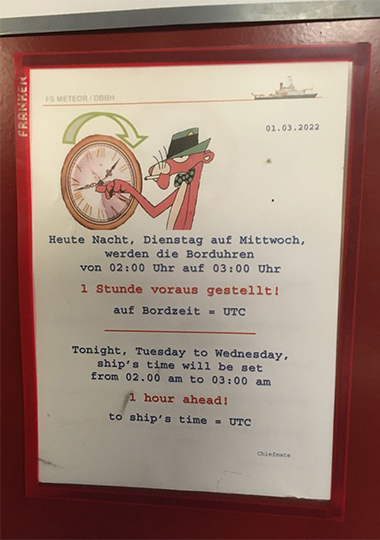
Time is very important to ship life, get it wrong and you miss breakfast, but it is a little more complicated than when on land. For our journey we boarded the Meteor in Uruguay (UTC -3), we disembark in South Africa (UTC +2) and we're constantly travelling east in between - what time zone should we use?
To solve this problem, we all live our lives onboard by ship time which changes throughout our journey. As we travel east from Uruguay, ship time is constantly updated to make sure the sun is roughly in the right position at the right time of day.
This has meant that we miss out on an hour of sleep every two days as we slowly make our way back to the future. This Tuesday night (01.03.22) we change time for the third time, bringing us in line with the Universal Time Coordinate (UTC) and one hour behind Germany. Ship time will stay here for the next weeks while we are in our working area then change again as we travel to South Africa.
It can be tiring losing sleep so many times in one week. But it does make for a great excuse should you ever miss a meeting!
Text by Ryan Mole
02 March 2022: What is a CTD?
The CTD device is used to explore the water column and helps to better understand its physical and chemical properties based on acquired data. The abbreviation CTD stands for conductivity (C), temperature (T) and depth (D).
CTD sensors measure the change in conductivity and temperature of the water column as a function of depth.
Conductivity gives information about how well a solution (in our case water) conducts electricity and is directly related to temperature and salinity. The depth can be calculated from the measured pressure. In addition, density can be determined from salinity and temperature.
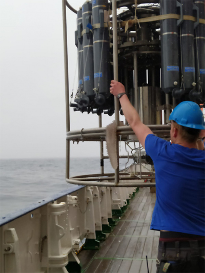
The CTD is attached to a metal frame, the rosette, which carries water sample bottles. First, the CTD is lowered to a depth of about 10 m to start the pump that moves the water past the sensors. Measurements begin once the instrument is back at the water surface. After the instrument has been lowered through the water column to the bottom, a decision is made on the depth of water to be sampled based on the CTD profile obtained. The CTD bottles are filled in the desired depths and the instrument package is hoisted back on board.
Text by Janne Scheffler
02 March 2022: Using sound waves to calculate water current velocities
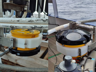
A Lowered Acoustic Doppler Current Profiler (LADCP) is a hydroacoustic velocimeter similar to a sonar. LADCP systems are routinely used to collect full-depth profiles of ocean velocity. These profiles could be analyzed both for horizontal and vertical velocity. As the definition implies, LADCP measures water current velocities following a significant principal of the sound waves, the Doppler Effect: “A sound wave has a higher frequency, or pitch, when it moves to you than when it moves away”.
But how is this implemented? The LADCP transmits sound at a specific high-value frequency into the water. As the sound travels, it encounters moving particles in the water and reflects back to the instrument. The discrimination between the reflected sound waves, frequency-wise is determined by the Doppler Effect:
- Water particles moving from the instrument, reflect lower frequency waves
- Water particles moving towards the instrument, reflect higher frequency waves
The frequency difference between the sound waves LADCP transmits and receives is called the Doppler Shift. The instrument uses that shift to calculate how fast the water particles around it are moving thus the current speed at different depths.
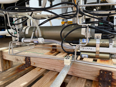
On M180 cruise, CTDs (Conductivity-Temperature-Depth) along with LADCPs are placed onto the Rosette water sampler (1). Specifically, two LADCPs are used, one attached at the bottom looking upwards and one at the top of the Rosette pointing downwards (2) both of them measuring velocities approximately 120m above and below the water sampler. After Rosette emerges back to the surface, the data is transmitted to the computer via a cable. The obtained data will be further analyzed to combine the individual measurements and obtain horizontal velocity profiles over the whole water column. The profiles will be used to characterize the structure and behavior of Internal Gravity Waves (IGW) in the Walvis Ridge region and later to compare them to IGW in different regions all around the Atlantic Ocean.
Text by Nikos Lymperis
02 March 2022: Waves of solidarity
Even though we are currently in the middle of the vast South Atlantic Ocean, surrounded only by several thousand metres deep water as far as the eyes can reach, the rather limited internet connectivity that connects us to the rest of the world has brought to us the disturbing news of the war.
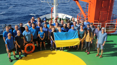
While we are sailing the ocean for science, away from the comfort of our home and warmth of our families, the discomfort caused by the news of the attacks and its consequences is far greater. Conversations over meals have shifted from science strategies to discussion of the war. The mood is grim and the spirits low. We, the scientists and the crew on board RV METEOR as a part of the SONETT expedition, extend our solidarity to the people of Ukraine. We condemn the attacks and urge for immediate restoration of world peace. We hope the situation is resolved soon, and that when we return to the land it is as peaceful as we left it not so long ago.
Text by Manita Chouksey
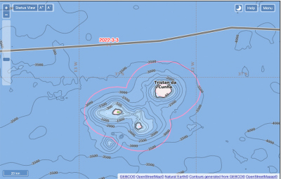
03. March 2022: Ahoi Tristan Da Cunha!
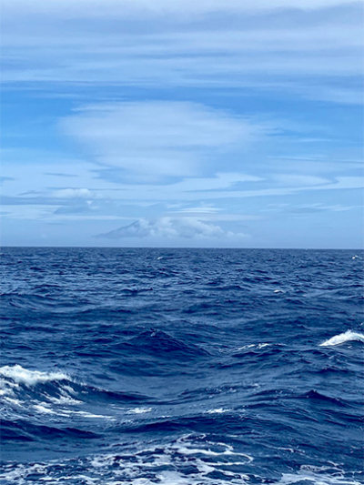
On March third, we passed the South Atlantic volcanic island of Tristan Da Cunha on our way to our working area. This is known for being the most remote island in the world - and we were able to see it (albeit to a small extent).
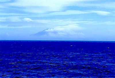
From a distance of 20 nautical miles, we could catch a glimpse of its outline under the cloud cover. Fortunately, the island allowed us to see at least one flank of the 2000m volcano. Despite the limited visibility, we were happy to get close to such a remote place. Certainly not many people can say this about themselves.
04 March 2022: Gliding through the Ocean
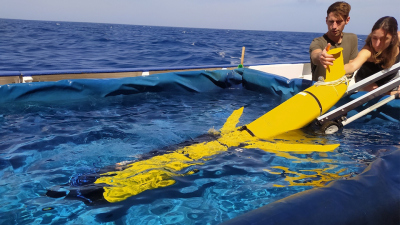
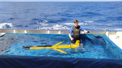
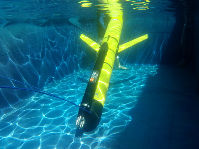
Sebastian, Comet and Jimi (Hendrix) are our three underwater gliders. They look almost like space shuttles, but instead of discovering the outer space, they dive deep into the ocean.
While Sebastian and Comet dive 100 metre and 200 metre, Jimi can go down up to 1000 metre. But how do they do that?
Maybe, you experienced something similar during your last swim in the ocean:
When you are in the water and breath in deeply, it is quite easy to stay at the surface, but when you breath out, you start to sink. The gliders do something similar. Let's focus on Jimi here: Instead of breathing out light air, Jimi "breathes in" heavy oil. He starts to sink. [To be more exact, he pumps oil from an outer to an inner bladder, which decreases his floatation. He has the same mass, but a smaller volume to keep him at the surface.]
At a depth of up to 1000 metre, Jimi "breathes out" the heavy oil. He starts to rise. Sebastian & Comet are a bit different. Instead of oil, they use air.
As they dive through the ocean, a part of their downward motion is converted into a forward motion by shifting weight inside, and through the lift generated by the hull and wings. This way, they can speed through the ocean with up to 30-40 Centimetre per second. In a day, they cover around 20 kilometre horizontally.
With them, they carry along several instruments: One of them is a CTD sensor, which measures how salty and cold the water is at each depth. Other sensors measure tiny fluctuations in temperature and velocity shear. By "breathing in" and "out" they go up and down in the ocean to measure what happens at different depths.
To send us these data, they inflate an additional air bladder at the surface to raise their fin above the water. Using the antenna in their fins, they can now communicate with our on-board antenna or the satellite communication network Iridium.
Equipped with all these instruments, they will help us to better understand the ocean. Wish them a good journey and stay tuned!
Text by Emelie Breunig
05 March 2022: Artistic inspiration
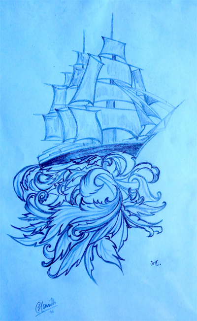
During our rather long transit time to our scientific working area in the Southeast Atlantic Ocean, there is some time for other activities while we wait to get started with our science work. The calming seascape with dancing waves and the picturesque sky with clouds playing hide and seek with the sun and the moon, provide infinite inspiration for artistic endeavours. Being an artist myself, I couldn’t help but draw out my inspiration on paper, resulting in a blend between realism and an escape into fantasy. Art can also sometimes facilitate scientific thought process and science can inspire art —some of the greatest artists in history have been scientists too!
Text by Manita Chouksey
06 March 2022: Arrival
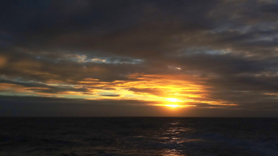
After sailing thousands of nautical miles through the South Atlantic Ocean, starting from the west, and crossing the mid-Atlantic ridge, and being in transit for 12 days, the wait is over! We have been following changes in the sea surface height on satellite images to identify important oceanic processes to locate our working stations and collect scientific data for the expedition. We are set to arrive at the first station of our working area in the Southeast Atlantic Ocean today at 7pm UTC. There was a light rain shower in the morning, the whole day has been overcast, and the sea has been full of rough waves; but the sun finally appeared—even if momentarily—to bid us farewell in the evening as it set below the horizon. With this imagery and a lot of excitement to begin the scientific work, it is time to put our instruments to our work and reveal the secrets hidden in the depths of the ocean!
Text by Manita Chouksey
06 March 2022: CTD: The first cast
The CTD-Rosette system was set to go down to depths below 5000 meters, and with the help of the deck unit on board we can track the CTD profile in the water and also get real time information on temperature, salinity, and density. Everyone was excited about the first CTD cast and the CTD lab had more spectators that it has the room for! Everything seemed to be working fine. Until it didn’t. On the very first cast the device stopped communication at about 800 meters depth. No connection with the deck unit meant that we had to bring back the device on board. Usually, such an error means there is possibly a loose connection somewhere and our first course of action was to replace all the connecting cables on the CTD with spare ones, that we have brought with us.
So, the CTD is unmounted from the Rosette by unscrewing the fixtures, all the cables are disconnected from their ports, the ports are cleaned using a cleaning solution and then well dried, and the new cables are fixed. Now the CTD needs to be tested for connection with the deck unit. A test connection was successful and the CTD was able to connect with the deck unit. The CTD is now ready to be in the water.
Meanwhile, turbulence measurements using the Vertical Microstructure Profiler (VMP) are being made on the further end of the deck. This was done during the time we lost during fixing the CTD, because on a ship we cannot afford to lose time to do science!
Text by Manita Chouksey
07 March 2022: VMP: Vertical Microstructure Profiler
Mostly in between sets of CTD and LADCP casts, we deploy a vertical microstructure profiler (VMP) as part of the time series stations, which can measure very tiny and rapid velocity and temperature fluctuations in the ocean. These observations can be used for estimating the dissipation rates of turbulent kinetic energy.
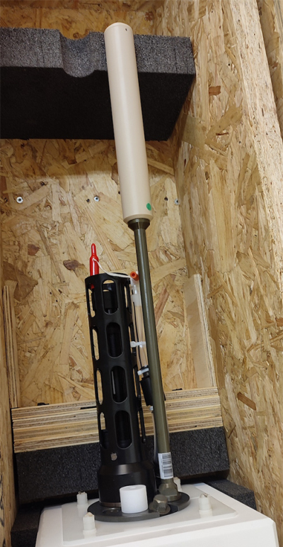
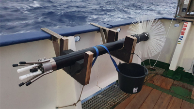
Our VMP (shown in one picture, we named her “Marea” – that’s ‘tide’ in Italian) can operate in depths down to 1000 m and sinks with a speed of about 0.65 m/s. The instrument is fitted with two shear probes, one or two thermistors, a pressure sensor and a compact Conductivity-Temperature (CT) sensor; this setup is very similar to the MicroRiders on the gliders. The VMP has a characteristic tail section, with a drag brush attached to the pressure tube, which helps stabilising the speed and tilt of the instrument during profiling.
During a deployment, the VMP is lowered over the stern of the ship, which moves with a speed of 1 kn, and falls freely to around 900 m. The instrument is recovered using a mechanical winch and directly re-deployed, since it is not necessary to bring the VMP back on deck between the deployments.
A two-hour block of microstructure casts is sufficient to complete three profiles, with each profile taking about 40 minutes. The deployments are done by a team of two people: one person operates the winch, helped by the second person, who leads the tether from the spool and ensures that enough rope is in the water at any given time, as the VMP must be deployed on a slack line in order to fall freely.
The sensors on this instrument are super fragile, and although we brought many spares, we’re happy that we didn’t break any of them during more than ten deployments so far!
Text by Letizia Roscelli
07 March 2022: CTD: It gets worse, before it gets better
With the new cables, the CTD seemed to work fine, but we still needed to figure out the reason of the error. What could it be? Could it be the cable on the winch that connects the deck unit to the CTD and that carries the Rosette up and down through the ocean depths? This seemed unlikely, for the ship’s winch cable is strong and sturdy and specially made for this purpose and can withstand prolonged exposures to water and depth. But to locate the exact source of the error, it needed to be tested—and so it was.
Thereafter, after a few more issues with the connection and sensors, finally the CTD worked smoothly without any issues and we were able to make several successful measurements. A few more casts were successfully done throughout the day, and this raised our spirits considerably to continue making measurements through the night. The weather has been bad the last few days with rough waves crashing on the deck, and the resulting ship’s movements has kept some people from sleeping, while for some of us it is the issues with the CTD that has kept us awake. Hoping that all goes well in the coming days!
Text by Manita Chouksey
08 March 2022: CTD: Journey to the bottom of the ocean
It can take about 2.5 hours for the CTD Rosette system to make a round trip through 4000m water column. In that time the longer winch cable was fixed and was ready to be used for the next cast. The next CTD cast was set to go down close to the bottom of the ocean. Starting from the late-night hours of yesterday and continuing to the early morning hours of today, roughly 3 hours, the first deep CTD cast to about 5200m was successful. We were now ready for the next one, and soon after the CTD was prepared for the next cast and then lowered into the water. All went well and the CTD was successfully lowered into the water until depth of about 5200m. And then…and then on its return journey upwards, the connecting cable snapped at about 4000m ocean depth and the CTD-Rosette system, with thousands of meters of the winch cable attached to it, was lost into the ocean.
Just when we had begun to think it cannot get any worse, it did. We had intended it to get as close to the bottom as possible, but not that close! This event was a shocking catastrophe, to say the least.
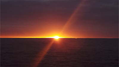
The sun peeks through the clouds waving us goodbye, as it set below the horizon to rise in another sky. Photo: Manita Chouksey
As soon as the daylight hit, we began the rescue mission to look for the lost CTD-Rosette system and dredging continued the whole day with little success. Thankfully, there is a backup CTD-Rosette system on board which can be used to make further measurements. At the same time, we had to also think of alternate science strategies and how to make up for the lost time and continue measuring oceanic processes from other instruments. Overcast clouds shielded us from sunshine the whole day, and the dullness of the cloudy sky combined with sad events from early morning made everyone gloomy. Thankfully, at the end of the day the sun appeared on the horizon in its spectacular form and brought us some moments of hope and delight.
Text by Manita Chouksey
11 March 2022: Little Things, Big Impacts
One of our instruments is attached to the bottom of the ship and runs almost constantly: the vessel-mounted ADCP fires pulses of sound down into the ocean and listens for any echoes coming back. When we know how long an echo took to return, and if the sound of it changed on its journey, we can calculate the speed and direction of water movements at different depths below the ship. Unfortunately, this means we get no measurements if there isn’t anything in the water to return an echo.
When we look at the strength of the signal from this instrument since leaving Uruguay, a strange pattern emerges. During the night, we get information from all the way down to 600 metres where the echo becomes too quiet to hear. During the day, a gap in our signal starts to emerge just after sunrise and closes just after sunset. The strength of our signal increases near the surface whilst at the same time we get no echoes bouncing back from deeper waters, particularly around 300 metres.
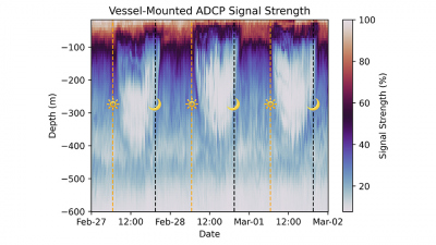
This is all due to the movement of microscopic plants and animals known as plankton, which are almost too small to see with the eye but are excellent for bouncing back an echo. Every day they migrate for hundreds of metres: to the surface 100 metres where there is light and they can feed and photosynthesise by day; back down to dark deep waters by night where they hide from predators and get rid of waste.
This migration happens every day across much of the ocean and globally is an important route for getting nutrients and carbon into deeper waters. It's very interesting that we can see this happening in our signal, but really quite rude of the plankton not to consider the quality of our data.
Text by Ryan Mole
15 March 2022: A Drifting Passenger
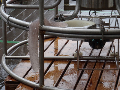
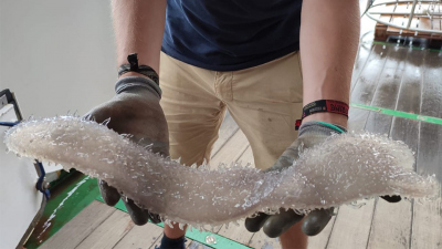
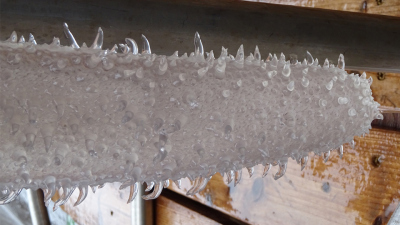
When you lower scientific devices into the depths of the ocean, it can happen that you accidentally pull up a by-catch. This can be plants or even animals and rocks.
On Wednesday at the CTD station, we pulled a worm-like animal out of the water. The semi-transparent tube looked almost plastic and had interesting nubs of different sizes growing on its mantle. No one immediately knew what we had unwillingly caught there. The first idea was that it could be a sea-cucumber. After a while, however, it was discovered that it was called a ”Pyrosome”. This is basically a colony consisting of several thousand individual animals. Especially during the night watches we noticed that these tunicates can often be seen close to the water surface. They then appear not only bright white, but also somewhat pink.
Text by Janne Scheffler
18 March 2022: Weather on the ship
On the FS METEOR, there is an on-board weather station which is staffed by employees of the German Weather Service. Ship deployment and research activities are highly dependent on weather and sea conditions. In order to be able to carry out the use of scientific devices and equipment optimally and without damage to the ship and crew, meteorological advice to the ship's captain and chief scientist is very advantageous.
The FS Meteor's on-board weather station is a meteorological observatory equipped with measuring instruments and systems in accordance with the guidelines of the WMO (World Meteorological Organization). The weather technician carries out eye observations and observations of the swell during the day. Every day, weather balloons are launched from board on the high seas.
Weather forecasts for the ship and other advisory documents are sent by the Maritime Weather Advisory from Hamburg to the on-board weather station. The weather technician conveys and explains the forecasts for the morning bridge meeting of the ship's management and the scientific participants.
The sea weather reports on the on-board intranet and on the "Bulletin Board" notice are available to all participants. This also includes further information, such as current satellite images, ground analysis maps, meteorological topics of the day and the "home weather reports".
Which weather elements are measured and observed? What can a weather balloon measure? How far and how high does it fly? And how does a working day of a weather technician look like? Stay tuned for more posts!
Text by Andreas Raeke
21 March 2022: Jumping (Scan-) Fish
The flying fish now get competition by our newly deployed instrument: The Scanfish is an instrument, that is towed behind the ship and measures temperature, salinity, fluorescence and oxygen. The latter two relate to biological activity. It goes 160m up and down the water column like a yoyo and at the beginning it was so excited that it even jumped out of the water. With the Scanfish towed behind the ship, we are currently crossing the eddy in several transects -- cutting right through the middle and later going along its sides. By this we want to see, where the cold water from the south and the warm water form sharp boundaries (fronts) and how these water masses mix.
Text by Emelie Breunig
Scanfish jumping out of the water. Credits: Emelie Breunig
24 March 2022: Sailing the ocean for the first time on a Research Vessel
Before the voyage started, I informed myself extensively with acquaintances about the way of life on a research ship. The experiences ranged from: "The cabins are cleaned regularly" to "Be sure to take bathing slippers, otherwise you won't want to go into the showers". The abundance of different experiences was quite confusing, which is why I ended up just packing a lot to be as prepared as possible.
The ship seemed so big at the beginning that I kept getting lost. The fact that no one mentioned which rooms were on which floor, but rather what colour the deck was, wasn't particularly helpful in finding my way around.
And then there are just a lot of people on board. To help match faces with names, a poster of all the scientists on board was made at the start of the journey, and all the current crew can be found on the ship’s intranet pages. Despite the size of the ship, it is hard to have time for yourself. I have been asked by friends whether one doesn't feel lonely on the open sea without land far and wide. The answer is a simple one: NO. We work together during the day and play together in the evening. I definitely have more social contacts than during the whole Corona period.
Furthermore, everything is much more comfortable than I thought. If you need more exercise, you can just go to the gym. On Wednesdays, there is a movie night with popcorn in the conference room. In the mornings, you do yoga together outside. Meal times are the strongest structure that remains in an otherwise permanently changing daily routine. We work in shifts, supposedly, but…, but every day there is a new task and you also help where you can outside of your working hours.
There was a storm last week that made me feel really cooped up for the first time. We weren't allowed to go out because of the bad weather conditions - that included everything from the main deck at the bottom to the ‘peildeck’ at the top. In that situation, all the people in a limited space became a bit too much for me. So I was glad that my bed had a curtain so I could get a bit of peace and quiet. But that feeling was also quickly over as soon as normal everyday life was restored.
Text by Grete Boskamp


