
Page path:
- Home
- Discover
- Media Releases
- Media Releases 2013
- 28-05-2013 Hothouse Icehouse - Tectonic separat...
Hothouse Icehouse - Tectonic separation of Antarctica and Australia cooled the climate
May 27, 2013

Land bridges and gateways
The land bridge between Australia and Antarctica had a profound effect on the surface ocean circulation in the Eocene Southern Ocean, until 49 million years ago. Just like the small strip of land of Panama today prevents exchange of watermasses between the equatorial Pacific and Atlantic Ocean, so formed the Tasmanian Gateway an effective barrier for circum-Antarctic circulation of surface water. Plate tectonic motion between Australia and Antarctica caused an opening in this land bridge, allowing throughflow of surface water from the southwest Pacific Ocean into the Indian Ocean from 49 million years onwards.
“Through tectonic reconstructions, it was already known that Australia and Antarctica slowly drifted apart over the last 80 million years”, says Peter Bijl, Antarctic paleoclimate scientist of Utrecht University and lead author on the paper. “What we did not yet know, was how and when exactly this tectonic motion influenced the ocean circulation. Now we understand that the changed ocean circulation caused climate cooling.”
Fossils
The scientists interpreted the changing ocean circulation by investigating fossil remains of unicellular algae in sediment cores from both sides of the Tasmanian Gateway. These sedimentary archives became available through ocean drilling expeditions around Tasmania and Antarctica by the Integrated Ocean Drilling Program (IODP). Prior to tectonic opening of the Tasmanian Gateway, the scientists found a strong difference in species composition of the fossil algae between both oceans, evidencing a clear separation of both water masses by the Tasman Land Bridge. From about 49 million years onwards, the species composition changed to strongly similar compositions, which lead the scientists to infer the onset of throughflow of surface water across the Tasmanian Gateway.
Climate change
The analyses on fossil molecules enabled the team of scientists to reconstruct a cooling of both surface waters and Antarctic air temperatures, coeval to the development of the revised oceanic circulation through the Tasmanian Gateway. This onset of cooling terminated the early Eocene hothouse, and continued cooling ultimately gave rise to the development of continental-scale glaciations on Antarctica. “These recent discoveries show that the opening of critical oceanic gateways had a profound influence on the evolution of the Earth’s past climate”, as Bijl concludes.
Publication:
P.K. Bijl, J.A. Bendle, S.M. Bohaty, J. Pross, S. Schouten, L. Tauxe, C.E. Stickley, R.M. McKay, U. Röhl, M. Olney, A. Sluijs, C. Escutia, H. Brinkhuis en Expedition 318 Scientists. Eocene cooling linked to early flow across the Tasmanian Gateway. PNAS.
Video material:
Mehrteilige Serie von Kurzfilmen zur IODP Wilkes-Land-Expedition
More information, images, interviews:
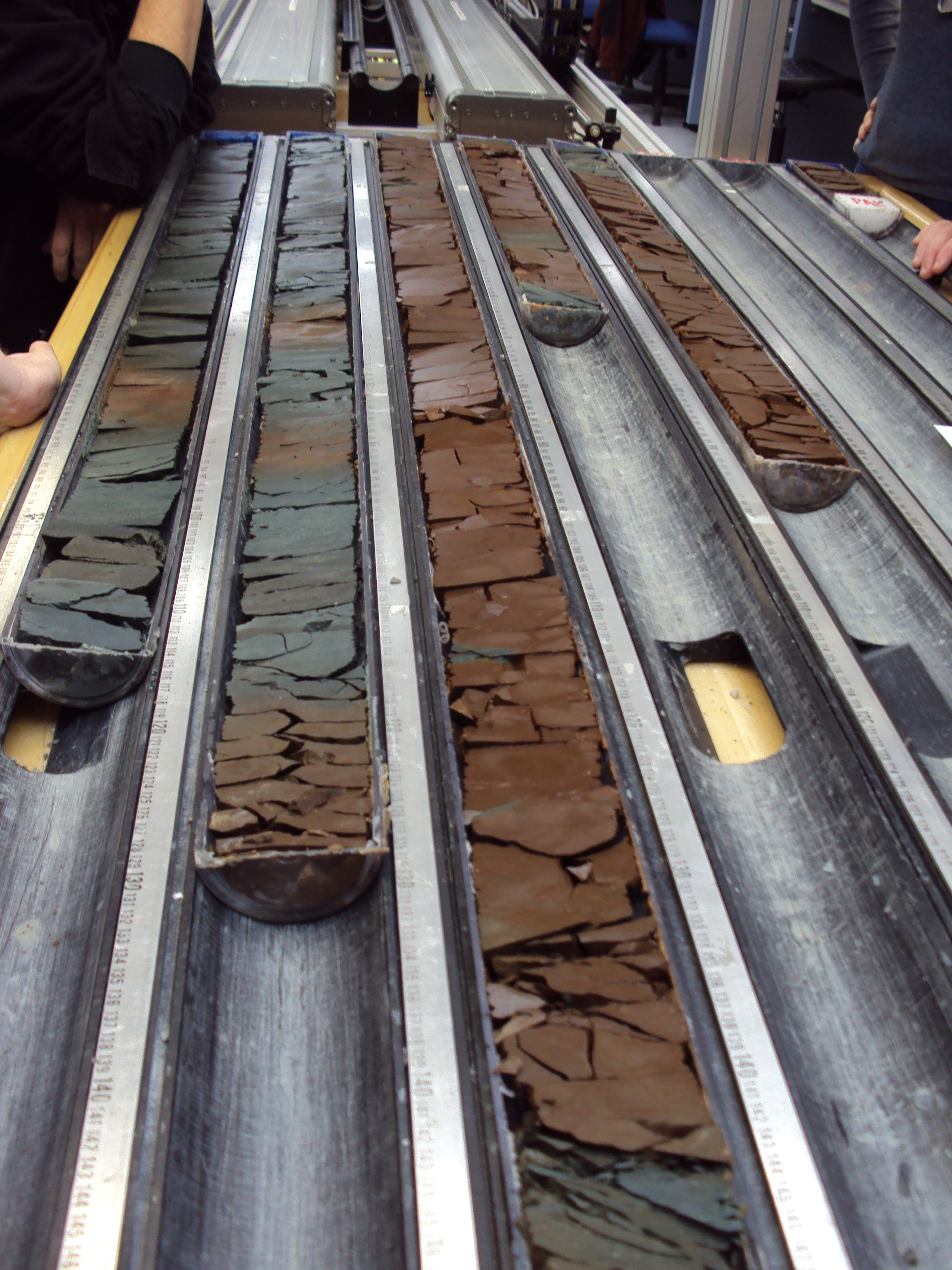
A drill core from the Antarctic Margin, sliced in half. Photo: Shipboard Scientific Party IODP Leg 318.

Schematic image of the opening of the Tasmanian Gateway between Australia and Antarctica during the Eocene (~50 million years ago) and the consequences for the ocean circulation. Continents are shown in dark gray, shallow seas in light gray. Deep ocean floor is indicated in white. NZ=New Zealand. Illustrations: Bijl et al, PNAS