- Startseite
- Christian Hilgenfeldt
- Electromagnetic Imaging System
Electromagnetic Imaging System
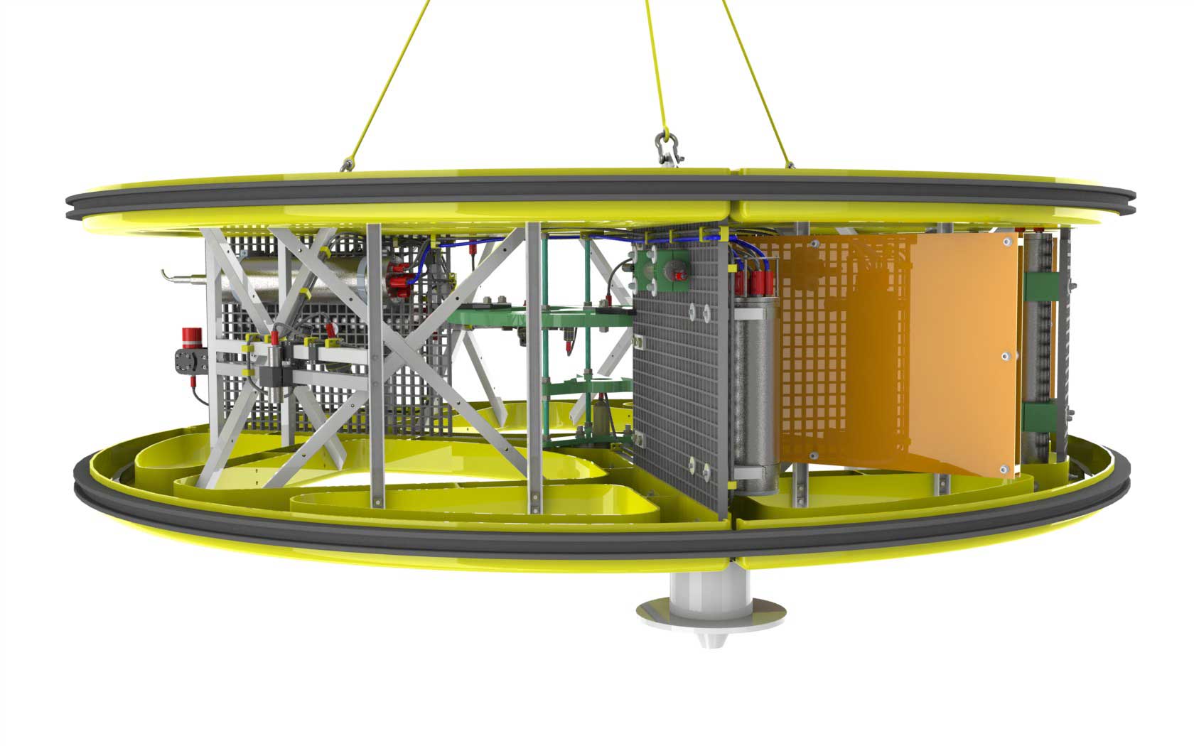
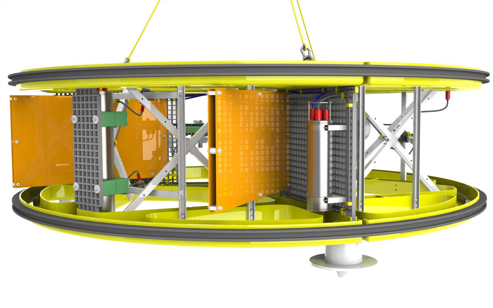
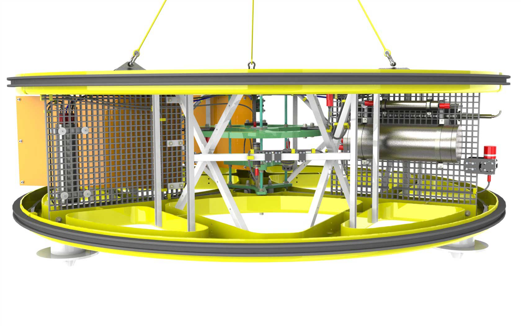
The Electromagnetic Imaging System (E.I.S) is a development based on the benthic electromagnetic profiler MARUM NERIDIS that approved his capabilities in a number of coastal and continental shelf surveys.

The E.I.S. is a novel, worldwide unique deep-sea platform for electromagnetic sensor systems for exploration at the seafloor. The instrument support is made of glass fiber reinforced plastic and has a diameter of three and a half meters. The core piece is the electromagnetic sensor system developed at the University of Bremen with horizontally arranged transmitting and receiving coils. The E.I.S lands on the seafloor or glides over it with a small ground clearance to enable high-resolution EM mapping of the electrical conductivity and magnetic susceptibility of the subsurface at water depths of up to 5,000 m. The fiberglass structure is designed to cause minimal scattering of the electromagnetic fields generated by large horizontal induction loops with a maximum diameter of 3.34 meters. The Operation frequencies between 10 Hz and 20 kHz can be combined and jointly inverted to resolve the resistivity structure of the topmost 10 to 20 meters below seafloor.
The E.I.S. is also equipped with video cameras, light, altimeter, sonar and acoustic positioning to obtain valuable image material and to bring the system safely down to the sea floor. Real-time data transmission and power supply is provided via fiber optic and copper conductors in the ship's own deep-sea cable to the telemetry unit, which is also mounted on the equipment rack.
System Layout

Photo Gallery