Die Inhalte dieser Seite sind leider nicht auf Deutsch verfügbar.
Seitenpfad:
- Sea Level change
- Coastal geomorphology lab
Coastal geomorphology lab
In our work, we use a number of field tool and analysis or modelling software to understand the evolution of coastal systems. Most of these tools are available at our ‘coastal geomorphology lab’. The laboratory was established thanks to the funding of the ‘Excellence Initiative’ and software available through MARUM and the University of Bremen.
We are eager to share our instruments with MARUM/ZMT colleagues, provided that the intended use does not conflict with our own research plans. Feel free to contact the group leader to enquire about the use of our equipment.
We are eager to share our instruments with MARUM/ZMT colleagues, provided that the intended use does not conflict with our own research plans. Feel free to contact the group leader to enquire about the use of our equipment.
GNSS
We use GNSS to obtain precise topographic measurements anywhere on the Earth’s surface.
Our main GNSS is a Trimble system composed by:
- Pro XRT Receiver
- Tornado Antenna
- Juno 5D handheld with Terrasync centimeter edition software
- Trimble LaserAce 1000 Rangefinder
Starting January 2015, we also have available a 3-years subscription to Omnistar G2 Global.
OmniSTAR G2 represents the most recent advancement in OmniSTAR subscription service offerings. It is a worldwide dual frequency high-accuracy solution which uses Orbit and Clock correction data. OmniSTAR G2 includes GLONASS satellites and GLONASS correction data in the solution. The addition of GLONASS to the solution significantly increases the number of satellites available which is useful when faced with conditions that limit satellite visibility, such as terrain, vegetation or buildings. OmniSTAR G2 service provides short-term accuracy of 1-2 inches and long term repeatability of better than 10 centimerers, 95%CEP. It is especially suited for operations in areas where trees or buildings may block the view of the sky.
For lower accuracy measurements, we use a BadElf GNSS system, a compact and portable device that collects data that can be postprocessed using nearby base stations.
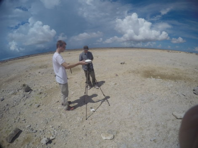
Measuring a fossil reef with high-accuracy GNSS
Drones (Remotely Piloted Aircraft Systems)
We use small remotely piloted aircraft systems to obtain low-altitude aerial photographs of areas of interest and reconstruct Digital Elevation Models through Structure-from-Motion. We use two types of drones:
- A small copter, hardware by DJI Innovations (model Phantom 2), modified to meet our custom specifications by flyingeye.fr.
- A fixed wing drone by Lehmann Aviation (model LA300)
On these drones, we mount different cameras according to the scope of the mission:
- Gopro4 camera with modified lens to avoid effects of the lens distorsion on photogrammetric reconstructions
- Canon S100 camera with firmware modified to shoot aerial pictures (CHDK)
- Sony RXIII
- Parrot sequoia NIR-VIS camera (from 2017)
As a base station, running the software necessary to set up and fly our drones, we use a Windows 8 ASUS tablet.
We are also in contact with companies in different countries active in the world of Unmanned Aerial Vehicles. These companies own drones that can transport heavier payloads and have experience in obtaining authorizations to fly in different countries. We have ourselves obtained authorizations to fly legally in different countries.
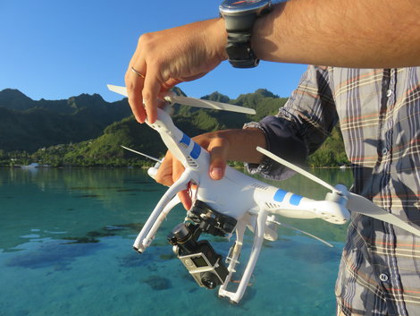
Our drone, ready to fly
Echosounder
Shallow water bathymetry
The BioSonics MX Aquatic Habitat Echosounder is a one-of-a-kind system for identifying and assessing aquatic habitat features. The MX is a complete hardware/software solution, packaged with unique processing and data visualization software, Visual Habitat MX, for classifying seafloor substrate and mapping submerged vegetation. With integrated DGPS, scientific transducer, and a rugged weatherproof housing, the MX echosounder system provides a turn-key solution for rapid assessment of submersed plants and substrate classification. This easy-to-use system allows for quick identification of rock, sand, and mud while also assessing plant canopy height and percent coverage. Even novice users will quickly learn to collect and process data and create powerful imagery to visualize results using Visual Habitat Software mapping tools.
The BioSonics MX Aquatic Habitat Echosounder is a one-of-a-kind system for identifying and assessing aquatic habitat features. The MX is a complete hardware/software solution, packaged with unique processing and data visualization software, Visual Habitat MX, for classifying seafloor substrate and mapping submerged vegetation. With integrated DGPS, scientific transducer, and a rugged weatherproof housing, the MX echosounder system provides a turn-key solution for rapid assessment of submersed plants and substrate classification. This easy-to-use system allows for quick identification of rock, sand, and mud while also assessing plant canopy height and percent coverage. Even novice users will quickly learn to collect and process data and create powerful imagery to visualize results using Visual Habitat Software mapping tools.
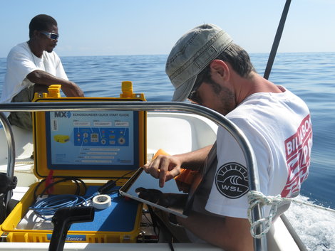
Working with the echosounder to measure nearshore bathymetry
Pressure-temperature transducers
Wave and tide measurements
We use portable pressure and temperature PT2X loggers to collect nearshore tide and wave data. Our transducers can be fixed to a chain or fixed to the sea bottom, and can collect data at high frequency (8 Hz) for several days.
We use portable pressure and temperature PT2X loggers to collect nearshore tide and wave data. Our transducers can be fixed to a chain or fixed to the sea bottom, and can collect data at high frequency (8 Hz) for several days.
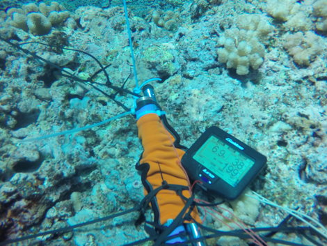
One of our pressure transducers attached to the reef bottom in Tahiti, French Polynesia
Geographic Information Systems
Geographic Information Systems
We use GIS for our daily work, from simple map design to advanced data analysis. We use high-performance PCs equipped with the following GIS software. All our PCs are connected to a Lenovo EMC cloud server, which backs up our data daily.
- DELFT 3d (SLCC group license)
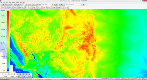
- Global Mapper (SLCC group license)
- Agisoft Photoscan (SLCC group license)
- Pix4D (SLCC group license - starting 2017)
- Trimble Pathfinder Office (SLCC group license)
- ArcGIS 10.2 (University of Bremen License)
- MATLAB (University of Bremen License)
- Qgis
- Grass GIS
- Google Earth Pro & Google Earth Engine access
- Surfer (MARUM License)
- Grapher (MARUM License)
- ENVI (SLCC group license)
