Seitenpfad:
- Startseite
- Entdecken
- Expeditions-Logbücher
- Logbuch SONNE
- Background information
Background information
Uncovering the Traces of the Great Tohoku Earthquake
One year ago, on March 11, 2011, a devastating earthquake struck off the north-eastern shore of Honshu. The Tohoku quake and the subsequent Tsunami killed more than 15,000 people. Now, one year later, German and Japanese scientists are setting out on an expedition with the German research vessel SONNE. From March 8 to April 6 they will investigate the traces that the earthquake left behind at the sea floor. Diving vehicles and other state-of-the-art marine technologies will be used in water depths up to 7,000 metres. “We plan to deploy instruments at the sea floor that will help us to better understand the development of such enormous earthquakes,” says Prof. Gerold Wefer, director of MARUM, the German Center for Marine Environmental Changes, at Bremen University.
On the afternoon of March 11, 2011, the earth trembled for 150 long seconds. Huge amounts of energy were released at the epicentre, 130 kilometres off the Honshu coast. In that region, the Pacific tectonic plate thrusts below Japan. The earthquake reached the very high magnitude of 9 because energy was released abruptly that had accumulated in the rocks since the last great earthquake here, which occurred in the year 869.
Subsequently the Earth’s crust ruptured along a distance of 400 kilometres. A segment of the Honshu coast was shifted eastward by as much as five metres. Displacements up to 50 metres or more were registered at the edge of the Japan deep-sea trench. The sudden movement of the plates raised the sea floor by as much as five metres over an area of 15,000 square kilometres, larger than the area of Greater Tokyo. Subsea landslides occurred, transporting large volumes of rock into the Japan trench.
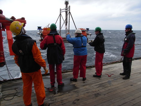
The expedition, initiated by Prof. Gerold Wefer, is funded by the German Ministry of Research and by the Deutsche Forschungsgemeinschaft (German Research Foundation). During two legs 33 scientists will initially deploy two deep-sea observatories in boreholes drilled during earlier expeditions. This will be carried out with the aid of the remotely operated vehicle MARUM-QUEST. These instruments will help to record future earthquakes more precisely.
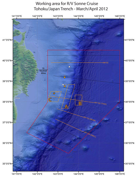
Secondly, the autonomous diving vehicle MARUM-SEAL will be deployed to map the sea floor very precisely with its multibeam sonar. MARUM-SEAL follows a course in more than 2,000 metres of water depth roughly 40 metres above sea floor. Moreover, the RV SONNE, with the aid of its built-in echo sounders, will map several longer profiles extending from the shelf off Honshu across the deep-sea trench. These profiles were already mapped in 2004 and 1999. A comparison of the maps will reveal changes in sea-floor topography caused by the Tohoku earthquake with great precision.
During the second leg the team of scientists will take samples at more than 7,000 metres of water depth from the bottom of the Japan trench. Investigating these sediment samples will reveal the quantities of sediment that were transported into the trench during and after the earthquake.
On April 6, 2012, the RV SONNE will return to the port of Yokohama a month after the start of the expedition. “I appreciate the funding by both the German Ministry of Research and the Deutsche Forschungsgemeinschaft,” says Prof. Gerold Wefer. “This expedition will stimulate cooperation between Japan and Germany in the field of marine sciences. It will serve as basis for new joint projects.”
Further information/photos etc.:
MARUM Public Relations
MARUM Public Relations

Working area RV SONNE off Japan.

Deployment of an ocean bottom observatory system.


